Tenerife Raises Storm Emilia Alert to Highest Level, Closes Roads and Parks
Tenerife's Cabildo has escalated its emergency plan to the highest alert, closing natural spaces and key roads from Friday in preparation for Storm Emilia, a powerful cold storm expected to bring severe weather, snow, high waves, and risks of landslides and flooding.
Tenerife's local government, the Cabildo, has raised its emergency plan (PEIN) to the highest alert level this Friday. This is in preparation for Storm Emilia, a powerful cold storm expected to hit the island hard. The storm began affecting Tenerife on Friday and is predicted to get worse on Saturday, according to the State Meteorological Agency (AEMET).
Starting at 3:00 PM on Friday, access is banned to all tracks, trails, paths, and off-road areas within Tenerife's Protected Natural Spaces. This is due to a high risk of landslides, falling trees, and flooding. People are also not allowed to stay in camps, camping areas, or recreational spots within these protected zones.
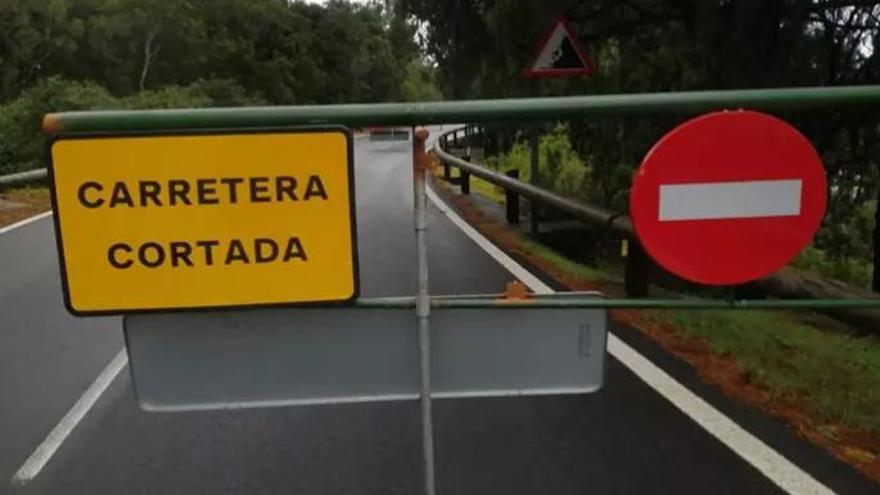
From 6:00 PM on Friday, several key roads will close because of Storm Emilia. These include the access roads to Teide: the TF-24 (from kilometre 24), the TF-21 (from kilometre 16, via La Orotava), and the ascent from Arafo (from kilometre 54, Boca de Tauce). The TF-445 road to Teno will also be shut.
Cabildo President Rosa Dávila urged everyone to be extremely careful. "We ask for the utmost caution, avoiding unnecessary travel, respecting the closures, and paying attention only to official sources," she said. Dávila added that emergency teams are ready, but the best protection comes from everyone looking out for each other. She emphasized that the Cabildo is taking early action to reduce risks from this "high-impact" storm, asking citizens to be responsible and stay informed through official channels.
Forecasts show that Storm Emilia will bring significant weather. The summits could see up to 5 cm of snow, especially on Saturday. Very heavy rain is expected, potentially reaching 100 mm in 12 hours. Wind gusts will be strong, over 90 km/h, particularly from Friday afternoon. The biggest concern is a severe sea storm, especially affecting the northern coast, with waves possibly over 6 metres high.
These measures, including closing Protected Natural Spaces and activating the highest emergency alert, are in response to a "real" risk of landslides, floods, falling trees, and powerful waves. Blanca Pérez, the Minister of Natural Environment, urged people to strictly follow all restrictions and safety advice.
The Canary Islands Government's Emergency Directorate has issued alerts for coastal conditions and wind, with the coastal alert possibly increasing to maximum on Saturday. AEMET has also put out yellow and orange warnings for rain, wind, coastal events, snow, and storms.
The emergency plan officially began at 3:00 PM on Friday, December 12. The emergency coordination centre (CECOPIN) will move to a pre-emergency phase from 8:00 PM on the same day.
These restrictions apply to everyone – residents, businesses, and authorities – except for authorized technical staff carrying out essential management and security work. Public transport services to Barranco de Masca and Punta de Teno are also temporarily suspended for the duration of the alert.
The Cabildo has issued several key recommendations:
- Avoid travel unless absolutely necessary, and if you must travel, do so with extreme caution.
- Check vulnerable areas, such as flood-prone zones, coastal areas, beaches, and busy spots.
- Secure outdoor items like street furniture, Christmas decorations, and anything that could be blown away by the wind.
- Local councils should activate their Municipal Emergency Plans (PEMUs).
- Always follow safety advice from civil protection authorities.
For the latest information and updates, the Cabildo de Tenerife reminds everyone to follow official channels and listen to instructions from civil protection authorities.