
Tenerife Heatwave Eases as Temperatures Drop Across Canary Islands
Tenerife and the surrounding Canary Islands are experiencing a gradual decline in temperatures as a heatwave eases, though moderate trade winds and localized heat persist in certain regions.
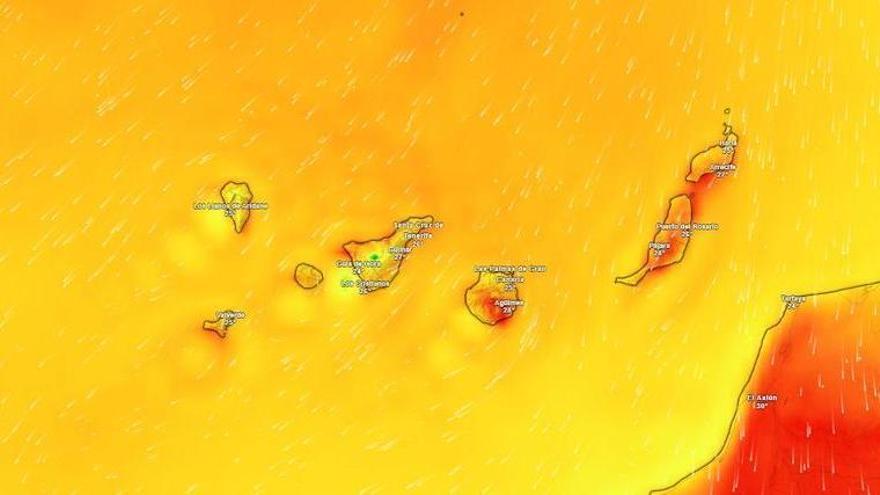
The intense heatwave that has gripped Tenerife over the past few days is finally starting to ease, according to the State Meteorological Agency (Aemet). After a long stretch of temperatures topping 30°C, the island will see some relief this Thursday, with the most significant cooling expected in the mid-altitude and mountain regions.
Temperatures today are forecast to range between 22°C and 29°C. This shift is being driven by moderate northeasterly winds, which may pick up strength in low-lying areas in the southeast and far west. Aemet has also warned of potential strong gusts toward the end of the day in the southeast, along the ridge, and across the central peaks. Skies will be mostly clear across the island, though the northeast will remain cloudy, with a slight chance of light rain by the evening.
This cooling trend is also affecting the rest of the Canary Islands. While Lanzarote and Fuerteventura will stay mostly clear—aside from some morning clouds in the north—the mountainous islands will follow a similar pattern to Tenerife, with clouds increasing on northern slopes overnight and a small chance of light drizzle.
Although temperatures are dropping, the heat isn't vanishing entirely. Aemet expects thermometers to still hit 30°C in parts of southeastern Lanzarote and Fuerteventura, as well as in the mid-altitude areas of southern and western Gran Canaria. The trade winds remain the primary influence on the islands' weather, continuing to dictate both temperature patterns and wind intensity.