Tenerife Faces Dust Alert as Temperatures Rise and Winds Gust
Tenerife faces a yellow alert for high surface dust from Sunday afternoon, accompanied by slight temperature rises and strong gusts on peaks.
Dust is expected to be a major feature of Sunday's weather in Tenerife. The State Meteorological Agency (Aemet) has issued a yellow alert for high levels of surface dust, which will affect the island from the late afternoon. The eastern islands will experience this alert earlier in the day.
In the early hours, the east of the western islands will be cloudy, but this should clear to little or no cloud by the morning. Other areas will have minimal cloud cover or be clear, with some medium and high clouds, particularly in the eastern islands.
There's also a chance of rain in the east of La Palma, which is currently under a yellow alert for this. This rain is more likely in the midlands and is expected to ease off during the morning.
Temperatures are set to rise slightly to moderately. Maximum temperatures will see a moderate increase, and this rise could be quite significant in the midlands and higher areas. Expect moderate easterly winds, which will become southeasterly on the peaks with occasional strong gusts.
Very strong gusts are also possible on the peaks of La Palma and Tenerife, as well as on the western slopes of Lanzarote and Fuerteventura.
Here's a breakdown for Tenerife province, according to Aemet:
The northeast will start cloudy with a small chance of light rain early on, clearing to little cloud throughout the morning. Other areas will have little cloud or be clear. Dust is expected in the latter half of the day, with a yellow alert for high concentrations, mainly on the southern and eastern slopes, from late afternoon. Minimum temperatures will rise slightly, and maximum temperatures will increase moderately, potentially significantly in high and northern/western midland areas. Winds will be moderate easterly, with breezes in the west. Strong southeasterly winds are expected on the central peaks and along the mountain range, with a chance of very strong gusts. These could occasionally affect the high midlands of the northeast.
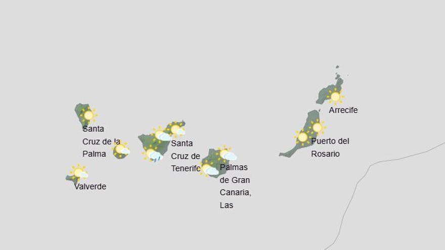
Predicted temperatures (°C): Santa Cruz de Tenerife: Minimum 20, Maximum 26.
For La Gomera:
The north will begin cloudy with a slight chance of early rain, clearing to little cloud by morning. Other areas will have little cloud or be clear. Dust is likely in the second half of the day, with high concentrations possible, especially on southern and eastern slopes later on. Minimum temperatures will rise slightly, and maximum temperatures will see a moderate increase, more noticeably in midland and high areas. Winds will be moderate northeasterly initially, turning east-southeast.
Predicted temperatures (°C): San Sebastián de La Gomera: Minimum 20, Maximum 27.
For La Palma:
The east will be cloudy with a chance of rain, more frequent in the midlands, easing during the morning. The afternoon should become mostly clear. The west will have little cloud or be clear, with some cloud intervals early on. Dust is expected in the latter half of the day, with high concentrations possible, mainly on the eastern slope later. Minimum temperatures will rise slightly, and maximum temperatures will increase moderately, particularly in midland and high areas. Winds will be moderate easterly, with strong intervals on the northern and southern edges. Very strong gusts are probable on the peaks during the first half of the day, and more occasionally in El Paso. Breezes are expected in the west.
Predicted temperatures (°C): Santa Cruz de La Palma: Minimum 17, Maximum 25.
For El Hierro:
The east will start cloudy with a low chance of early rain, clearing to little cloud by morning. Other areas will have little cloud or be clear. Dust is expected in the second half of the day, with high concentrations possible, mainly on the southern and eastern slopes later. Minimum temperatures will rise slightly, and maximum temperatures will increase moderately, more significantly in midland and high areas. Winds will be moderate northeasterly, with strong intervals at first. Easterly winds will dominate in the midlands and on the peaks.
Predicted temperatures (°C): Valverde: Minimum 15, Maximum 22.