Storm Therese Eases as Canary Islands Brace for Calmer Weather
Storm Therese is dissipating over the Canary Islands, bringing an end to a week of intense, unpredictable rainfall and severe weather conditions.
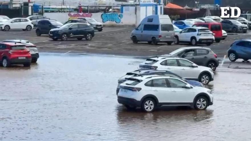
Storm Therese is finally losing its grip on the Canary Islands, signaling a return to calmer weather after a week of severe conditions. According to the State Meteorological Agency (Aemet), the heavy rain, strong winds, and rough seas are easing this Wednesday, with conditions expected to improve significantly by Thursday.
The rainfall over the past week has been intense, with some areas recording more than 600 liters per square meter. Because of the islands' varied terrain, rainfall has been highly localized; while some spots saw over 100 liters in a single day, nearby areas remained relatively dry. Roque de los Muchachos, for instance, recorded 242.8 liters in just 24 hours.
David Suárez, a representative for Aemet, noted that the storm was notoriously difficult to predict. Its erratic movement over the weekend made it challenging to issue precise warnings, particularly when stationary storm cells caused sudden, torrential downpours—such as the 60 liters per hour recorded in Tacoronte, Tenerife.
These events highlight the challenges of forecasting weather in island regions, where a shift of just 50 kilometers in a storm’s path can drastically change the impact on the ground. While most of the storm was covered by orange-level alerts issued three days in advance, the unpredictable nature of the rainfall required constant, last-minute adjustments to weather warnings.
Looking ahead, some scattered showers and occasional thunderstorms are still possible, particularly in the western islands. However, as the storm system moves away, the weather is expected to stabilize, with only light, isolated rain forecast for Gran Canaria and the western part of the archipelago.