New Tenerife Radar Boosts Canary Islands Weather Forecasts
A new 3-million-euro radar on Tenerife has significantly improved weather forecasting and storm warnings across the Canary Islands by eliminating coverage blind spots and enhancing accuracy.
Weather forecasting in the Canary Islands has significantly improved thanks to a new radar recently switched on in Tenerife. The State Meteorological Agency (Aemet) says this new equipment, placed 1,343 meters high on Mount Cruz de Gala in Buenavista del Norte, is a major step forward. It will make forecasts and warnings much more accurate, especially for rain and storms.
This is Tenerife's second electronic radar system. It works alongside an older one in Mogán, Gran Canaria, which has also been updated. Together, they fix a long-standing problem with radar coverage. Before, the Gran Canaria radar couldn't 'see' certain areas: west of Tenerife (because Mount Teide blocked it), northwest of La Palma, and west of El Hierro. Now, with the new radar, Aemet has full coverage across all the islands. It gets rid of these 'blind spots' in the province of Santa Cruz de Tenerife and can even detect weather closer to the ground.
This technological leap means Aemet can track weather fronts that bring rain and storms more accurately and earlier. Víctor Quintero, who directs the Meteorological Center in the Western Canary Islands, explained that they now have much more data. This helps them monitor these weather events in the short term, understand how they develop, and predict things like sudden changes in weather or the formation of storm cells.
The project cost three million euros and took over 25 years to complete, battling through bureaucracy and construction challenges. The need for a second radar on Tenerife was first identified back in 2000 by the National Institute of Meteorology at the time. Its development faced many hurdles. These included issues with the chosen company that stopped the plan in 2019, complex procedures to get the advanced technology, rising material costs due to global events like the war in Ukraine, and strict rules because it's located in the Teno Rural Park, a protected natural area.
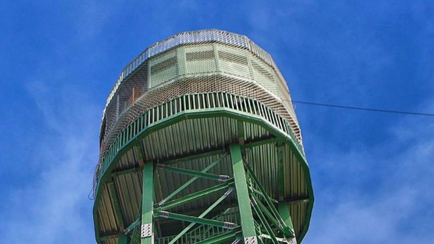
The radar's galvanized steel tower is 5 meters wide and 21 meters tall. It blends into the landscape because it's painted green. Beyond weather forecasting, it also acts as a lookout for forest safety, helping to spot fires early. This dual role means Aemet and the island council work together to manage it, as the council is mainly responsible for managing the island's forests.
The new system can figure out how fast low-pressure systems are approaching and estimate when they'll reach the islands. It has a range of 240 kilometers, covering all of Santa Cruz de Tenerife province. A key technological upgrade is 'dual polarization.' This technique sends and receives signals in two different directions at the same time. This greatly increases the amount of data and improves accuracy. It allows for a much clearer distinction between types of precipitation like rain, snow, or hail, giving more thorough information for a full weather assessment. After the official handover of the construction last week, the radar has already started collecting data. It's currently undergoing technical adjustments and will soon be fully operational.