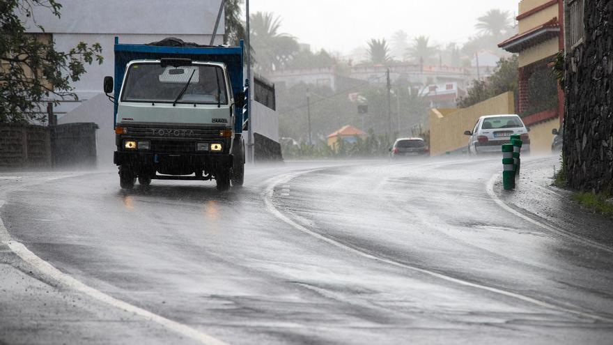
New Storm Threatens Tenerife, Heavy Rain Expected
Forecaster Rubén Vázquez predicts a new storm will bring heavy rain and "considerably increased instability" to the Canary Islands, especially Tenerife and Gran Canaria, from this weekend, with Saturday expected to be the worst day.
Tenerife might face a new storm soon. Forecaster Rubén Vázquez from MeteoVigo predicts "considerably increased instability" across the Canary Islands from this weekend. He advises caution, saying any weather scenario is possible.
The weather pattern is set to change significantly in the Canary Islands over the next few days. Much like mainland Spain, the islands will see a "repeated pattern" of heavy rain, particularly in Tenerife and Gran Canaria, with more unsettled weather starting Thursday.
Rubén Vázquez explains that Storm Bram is pushing a large weather front that appears to be heading towards the Canary Islands. He notes that "instability will clearly increase in the second half of the week" as a low-pressure system southwest of mainland Spain starts sending moisture towards the islands.
This weather event will bring more rain from Wednesday, especially affecting the northern slopes of the higher islands.
Vázquez's analysis of weather maps shows a stronger flow of moisture starting Thursday, bringing rain mainly to Tenerife and Gran Canaria. He stressed that "accumulated rainfall will start to be significant as early as Friday," when the storm's rain bands fully reach the islands.
Saturday is expected to be the worst day, according to Vázquez. He explains that the low-pressure system will be closer to the Canary Islands, allowing northerly winds to carry more moisture from the sea inland, making the rain heavier on northern slopes.
Both the GFS and European weather models agree, predicting especially high rainfall totals for Tenerife, significant amounts for Gran Canaria, and less for Lanzarote and Fuerteventura.
Unsettled weather will continue into Sunday as the low-pressure system shifts slightly east. This means Gran Canaria, Lanzarote, and Fuerteventura could see some of the heaviest rain towards the end of the event.
Rubén Vázquez emphasizes that this isn't a one-off event, but a pattern seen repeatedly in various weather models. He likened it to "the atmosphere taking a mold and repeating it three times." He explains that a breakdown in the polar front is causing several low-pressure systems to form southwest of mainland Spain and move south, directly impacting the Canary Islands.
While temperatures will stay mild, the islands will be affected by humid and slightly colder air higher up in the atmosphere. This is crucial for driving the rainfall expected in the coming days.