
Canary Islands Weather: Trade Winds Return as Temperatures Drop
The Canary Islands are set for a shift to cooler, windier weather this Thursday as trade winds return and Saharan dust clears across the archipelago.
The calm weather seen across the Canary Islands over the last few days is coming to an end this Thursday, May 28, according to the State Meteorological Agency (Aemet). The islands are shifting toward a cooler pattern as the recent Saharan dust (calima) clears and temperatures begin to drop, particularly in mid-to-high altitude areas.
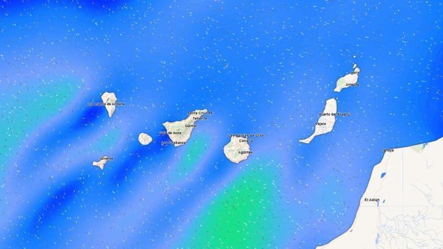
This change is due to the return of the trade winds, which are regaining their usual influence after the recent dust intrusion. Temperatures across the archipelago will generally fall, settling between 20 and 23 degrees Celsius. This cooling will be most noticeable inland and at higher elevations, while coastal areas will see a more modest decrease.
Northeast winds are strengthening, reaching moderate levels with stronger gusts expected on the southeast and northwest slopes of the higher islands. In Tenerife, particularly strong gusts are forecast for the western and eastern ends of the island. At the summits, winds will shift from west to northwest, blowing strongest in the early morning before easing later in the day.
Cloud cover will follow a typical pattern for the mountainous islands: the northern coasts will see intervals of low clouds that should clear by midday. A similar trend is expected in the western parts of Lanzarote and Fuerteventura. Elsewhere, skies will remain mostly clear, marking a transition to the cooler, windier weather typical of the Atlantic climate at this time of year.