Canary Islands on High Alert for Severe Coastal Weather
The Canary Islands government has issued a high alert for severe coastal weather across all islands, predicting strong waves and intense winds starting Wednesday at 4 PM.
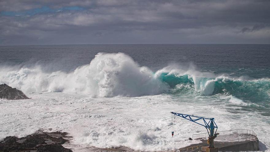
The Canary Islands government has issued a high alert for coastal weather across all the islands. This alert will begin at 4:00 PM on Wednesday, February 25. Forecasters from the State Meteorological Agency (Aemet) predict severe strong waves and intense winds will hit the islands, meaning emergency services are preparing for the potential danger.
The highest alert is for Tenerife, especially its north and west coasts. Here, waves from the northwest are expected to be over four meters high, possibly reaching five meters in the most exposed areas. El Hierro, La Gomera, and La Palma will see similar conditions along all their coasts. Other coastal areas in the Canary Islands are on a lower alert, with waves possibly over two meters.
Aemet also forecasts northerly winds of Force 7, with speeds between 50 and 61 kilometers per hour. These winds could sometimes reach Force 8, with gusts up to 74 kilometers per hour. The strong winds will start Wednesday afternoon in the channel between La Gomera and Tenerife, then spread to other channels between islands. This will make sea conditions more dangerous and could affect boat travel.
Because of this, the Directorate General of Emergencies has issued important safety advice. If you accidentally fall into the sea, move away from where waves are breaking, call for help, and don't swim against the current. Instead, try to let the water carry you to a calmer area. If you see someone in danger, throw them something that floats and immediately call 112, the Canary Islands emergency number. This alert means everyone should be extremely careful near the coast.