Canary Islands Issue Yellow Weather Alert for Strong Winds and Rough Seas
The State Meteorological Agency has issued a yellow weather warning for the Canary Islands as strong winds of up to 70 kilometers per hour and rough seas are expected to impact the region starting Friday evening.
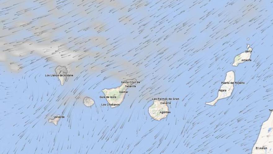
The Canary Islands are on alert again due to unstable weather, according to the State Meteorological Agency (Aemet). A yellow warning has been issued for strong winds starting at 9:00 p.m. this Friday. The winds will first hit Tenerife before spreading across the western islands.
Gusts could reach 70 kilometers per hour, with the strongest impact expected along the southeast coast, the far west, and the higher areas of southwestern Tenerife. Additionally, El Hierro and La Palma are under alert for rough seas, with northeasterly winds reaching force 7 and speeds between 50 and 61 kilometers per hour.
Temperatures are expected to rise slightly to moderately, though this will be more noticeable in the northern midlands and southwestern slopes. Haze will also be present, particularly on the summits and southern slopes. In the highest parts of Tenerife, light frost is possible over the coming hours.
Wind patterns will shift throughout the day. Early on, the strongest gusts will be concentrated in the midlands and mountain summits, especially along the Dorsal Mountain Range and the northwest. By the afternoon, the winds will intensify in lower-lying areas. Across the archipelago, skies will generally be clear, with some cloudy intervals in the north and northeast of the higher islands.
Because these wind episodes are common during seasonal transitions, authorities advise staying alert regarding infrastructure and coastal activities. The combination of haze and strong gusts may reduce visibility and affect daily operations until the winds shift toward the northeast later in the day, signaling the end of this unstable period.