
Canary Islands Heatwave Eases as Weather Alerts Lift
The Canary Islands’ extreme heatwave is subsiding as temperatures return to normal levels and weather alerts are lifted across the archipelago.
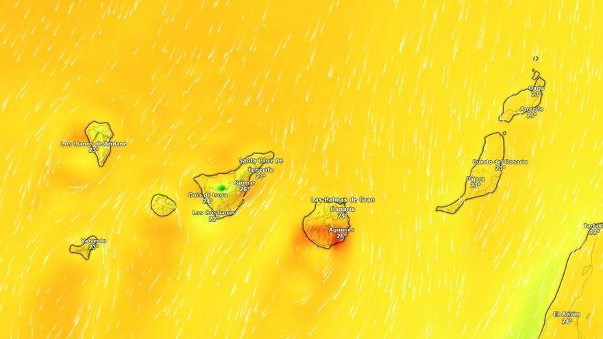
The extreme heatwave that has gripped the Canary Islands over the past few days is finally easing, according to the State Meteorological Agency (Aemet). After a sweltering Saturday, temperatures are expected to return to normal today, allowing officials to lift all yellow heat alerts across the islands.
While the intense heat is subsiding, summer-like weather will continue. Tenerife’s southern lowlands and the Güímar Valley will still see highs between 30°C and 32°C. Elsewhere, temperatures will drop, with the most noticeable cooling expected in inland areas and mid-altitude regions facing south, east, and west. Coastal areas will see a more modest decrease.
Haze will linger over the peaks and mid-altitudes throughout the morning but is expected to clear by the afternoon. Northern parts of the higher islands, along with the northern and western slopes of the eastern islands, will start the day with cloud cover that should clear by midday. The rest of the archipelago can expect clear or mostly sunny skies.
The return to more stable weather is being driven by the trade winds. These winds will blow strongly across the northwestern and southeastern slopes of the islands, as well as parts of Lanzarote and Fuerteventura. Gusts are expected to be particularly strong in Gran Canaria, La Gomera, and the southern side of the Tenerife metropolitan area, while local breezes will keep conditions milder along the western coasts.
This shift is typical for the Canary Islands, where the interaction between the Azores High and the islands' volcanic landscape often dictates patterns of heat and haze. The end of these weather warnings brings a welcome break for emergency services, which remain on high alert during heatwaves due to the constant risk of forest fires.