Canary Islands Face Temperature Drop and Strong Winds as Weather Shifts
The Canary Islands are experiencing a shift to cooler temperatures, increased cloud cover, and stronger winds as the recent period of calm weather comes to an end.
The Canary Islands are seeing a shift in weather this Wednesday, bringing an end to the calm conditions of the past few days. According to the State Meteorological Agency (Aemet), the islands can expect cooler temperatures, more cloud cover, and stronger winds from the north.
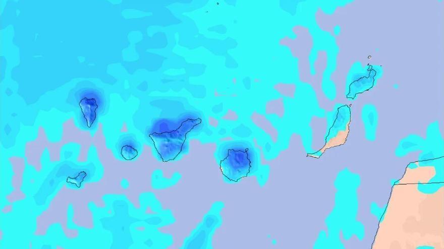
Tenerife will feel this change most clearly, particularly in the island’s interior and mid-altitude areas. In the capital, temperatures will drop to around 20°C. Light rain is expected, mainly in the north and inland, while Mount Teide may see some light frost. Stronger wind gusts are also forecast for the Dorsal, northeast, and far northwest regions.
The rest of the archipelago is following a similar pattern. Gran Canaria will see more clouds in the north with a chance of scattered showers, and temperatures will fall across the summits. La Palma, La Gomera, and El Hierro are also experiencing cooler, cloudier conditions. In Lanzarote and Fuerteventura, temperatures in Arrecife and Puerto del Rosario have dipped to 21°C and 20°C, respectively, accompanied by moderate winds that may pick up speed inland.
The change in weather is also affecting the sea. Swells from the northwest are expected to increase throughout the day as winds shift from the north to the northwest. Authorities are advising the public to stay alert, as the combination of wind and rougher seas marks a clear departure from the mild weather seen earlier this week.