
Canary Islands Brace for Heatwave and Strong Winds
The Canary Islands are bracing for a spike in temperatures reaching up to 34°C alongside strong winds and rough sea conditions this Wednesday.
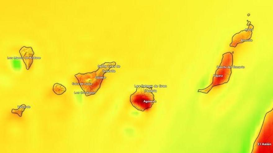
The Canary Islands are bracing for a spike in temperatures this Wednesday. According to the State Meteorological Agency (Aemet), the heat will be felt unevenly across the archipelago, with inland, mid-altitude, and higher areas expected to be the most affected.
Gran Canaria will see the highest temperatures, potentially reaching 34°C in the Tejeda basin and the southern and western mid-altitudes. In Tenerife, temperatures are forecast to hit 30°C across the eastern, southern, and western slopes, with some inland areas climbing to 32°C. Similar conditions are expected in La Gomera, La Palma, and El Hierro, where thermometers could touch 30°C in higher regions and on southern and western slopes. Fuerteventura will see temperatures near 30°C in the interior and southeast, while Lanzarote will remain slightly cooler, with highs around 28°C in Arrecife.
Strong winds will also play a significant role today. Aemet has warned of gusty conditions, particularly along the southeastern and northwestern coasts of the mountainous islands. In Gran Canaria, La Gomera, La Palma, and El Hierro, moderate to strong northeasterly winds are expected, which will impact both the temperature and sea conditions, with rough to very rough seas forecast. Gusts could become particularly strong by the afternoon in exposed areas.
As for cloud cover, the trade winds will bring overcast skies to the northern lowlands during the early morning, though these clouds should clear as the day progresses, leading to warmer conditions. Lanzarote and Fuerteventura will see some cloud, while the winds on the peaks of Mount Teide are expected to ease throughout the day. This combination of rising heat and persistent wind highlights how the islands' unique landscape continues to shape their local weather.