
Canary Islands Brace for Calima, Heat Spike and Strong Winds
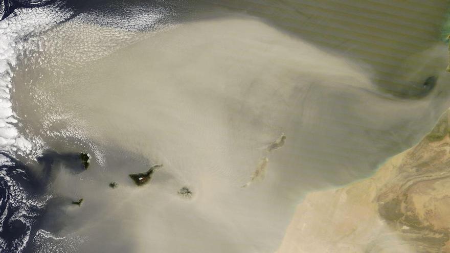
The Canary Islands are bracing for a spike in temperatures and reduced air quality as a Saharan dust event, accompanied by strong trade winds, hits the archipelago this Wednesday.
The Canary Islands are bracing for a day of unsettled weather as Saharan dust, known as calima, returns alongside a spike in temperatures. According to the State Meteorological Agency (AEMET), these conditions will be most noticeable this Wednesday, accompanied by strong trade winds across several parts of the archipelago.
Meteorological models suggest temperatures will climb toward 30–32°C in certain areas. In the capitals, Santa Cruz de Tenerife is expected to reach a high of 30°C, while Las Palmas de Gran Canaria will see temperatures between 21°C and 28°C. This warming, which will primarily affect low-lying and mid-altitude regions, coincides with high-level dust that may impact air quality and visibility.
Wind will also be a major factor. Moderate northeasterly winds are expected, with stronger gusts likely on exposed slopes and inland areas—particularly during the first half of the day in places like El Paso and the south of Jandía. At sea, conditions will be rough, with wind speeds reaching force 5 to 6 and swells of one to two meters.
Skies will vary across the islands; northern areas may see clouds that clear as the day progresses, while the rest of the region will enjoy mostly clear skies or high clouds. Given the combination of summer-like heat and strong winds, authorities advise residents to stay updated on weather warnings, especially in areas prone to intense gusts.