AEMET Issues Wind Warning for Canary Islands as Rough Seas Expected
Spain's State Meteorological Agency has issued a warning for strong winds and rough seas across the Canary Islands this Sunday, advising caution for residents and travelers.
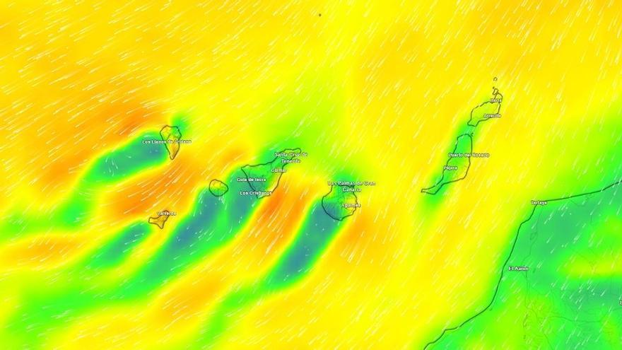
The State Meteorological Agency (AEMET) has issued a warning for windy conditions across the Canary Islands this Sunday. Due to the influence of the trade winds, residents and visitors are urged to exercise caution, particularly in exposed areas and at sea, where conditions are expected to worsen.
The weather will vary across the islands. The northern slopes of Tenerife, Gran Canaria, La Palma, La Gomera, and El Hierro will see cloud cover and a slight chance of light rain early in the day, while the rest of the region will remain clear. Lanzarote and Fuerteventura will start with some cloud but should see skies clear as the day progresses.
The main concern is the strengthening northeast wind. AEMET forecasts very strong gusts during the second half of the day, particularly affecting the peaks and the northwest and southeast slopes of Tenerife, as well as the high ground of Gran Canaria, La Palma, La Gomera, and El Hierro. On the eastern islands, the wind will be most noticeable in inland and southern areas.
Temperatures will remain stable. In Santa Cruz de Tenerife, highs will reach 22°C and lows will hover around 18°C. While most of the archipelago will see little change, there may be a slight drop in daytime temperatures in the north and east, and a minor rise in minimum temperatures at higher altitudes. Light frost is possible at the highest elevations of Mount Teide.
Coastal conditions are also a concern. Rough seas are expected, with wind force levels reaching 4 to 6, and occasionally 7. Combined with a northerly swell producing waves of 2 to 3 meters, these conditions may disrupt coastal activities and inter-island ferry services.