16th-Century La Laguna Digitally Rebuilt with AI
The University of La Laguna has digitally rebuilt the 16th-century city of San Cristóbal de La Laguna in 3D for the first time, using history, technology, and AI to offer immersive experiences of its past.
San Cristóbal de La Laguna, a city once defined by its lagoon, has been brought back to life. The 16th-century city of Aguere, known for its dusty streets and low-rise homes as described by Italian engineer Leonardo Torriani, has been digitally rebuilt in 3D for the first time. This ambitious project, led by the University of La Laguna (ULL), combines history, technology, and artificial intelligence to transport us back in time and help us better understand this city, which was named a World Heritage Site in 1985.
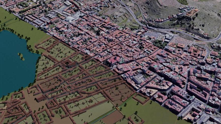
The project shows what the main city of the Canary Islands would have looked like in the late 1500s. At that time, it was the most economically and educationally advanced area of the Archipelago. People lived in the area now marked by the La Concepción church, Camino Largo, and the Francisco Peraza stadium. The city's layout has changed very little since then.
Fernando Pérez Nava and Isabel Sánchez Berriel, from ULL's Department of Computer Engineering and Systems, are leading this reconstruction. Pérez Nava explained that the idea for the project came from a partnership between the La Laguna city council and the university. Carmen Rosa Hernández, a cultural official from the council, first suggested it.
The task was challenging. Very few 16th-century buildings in La Laguna remain in their original state. So, the team, which includes experts in computer science, history, and fine arts, had to start almost from scratch. Their main guide was a map drawn by Torriani in 1588, which is kept at the University of Coimbra. They also used historical descriptions and compared architectural styles.
Pérez Nava admitted, "It was an extremely complicated job because practically nothing from that era existed in La Laguna." However, by using historical maps and with guidance from historians, the team successfully created the complete city plan – a major first step. After that, they could study how land was divided, the building methods of the time, the city's social structure, and the types of homes. They distinguished between wealthier and poorer areas, noting differences in materials and the design of doors and windows.
The result is a reconstruction covering over 20 square kilometers. It includes a complete digital version of the city and computer-generated models of more than a thousand homes, along with churches, convents, hermitages, and official buildings. The project also features virtual characters representing nobility, clergy, merchants, artisans, and farmers, all dressed in period-appropriate clothing.
The project has advanced significantly with the addition of artificial intelligence (AI) tools. As noted in a 2024 article, researchers are treating old historical maps like modern images. They use deep learning to automate the most time-consuming part of the process: identifying each house. They must rely only on Torriani's map because, as they say, "we cannot invent skyscrapers." The researchers explained, "Before, we had to examine each house one by one – its size, number of floors, doors, and windows – and now we have managed to automate that process."
Using advanced algorithms, the system can detect building fronts, correct distortions in the original map, and create 3D models that are both architecturally sound and historically accurate. For the most important buildings, they use detailed models based on LIDAR data – 3D information created by laser pulses that measure distances to objects – for more precise heights and volumes.
Isabel Sánchez Berriel, a specialist in Computer and Systems Engineering, recently shared the latest progress at the II Futura Cultura Lab Thought Conference. This includes an immersive application where visitors can freely talk with the city's virtual residents. Sánchez explained, "Unlike other projects, here the dialogues are not pre-established."
To make this possible, they have given generative AI all the historical and spatial information so it can respond logically. Even the language has been carefully chosen, using texts by Miguel de Cervantes to recreate the Spanish spoken during that era. Sánchez also pointed out that this method could be used for other historical maps.
The research isn't just for La Laguna. The team is already exploring how to apply this method to other Torriani maps of the Canary Islands, such as those for Santa Cruz de Tenerife, Garachico, Telde, Las Palmas, or San Sebastián de La Gomera. Their aim is to continue digitally rebuilding the historical cities of the Archipelago and make analysis easier with automated tools.
Beyond academic research, this reconstruction has led to many ways to share it with the public. These include virtual tours, 360-degree content, and virtual reality experiences where users can walk through La Laguna of 1588 using just a mobile phone. Educational video games set in this historical environment are also being developed. The doctors leading the project hope to launch the completed version early next year.